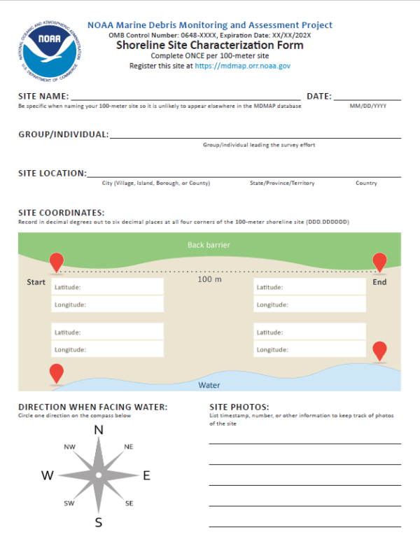
This Site Characterization Form is used to establish and describe a shoreline survey site and is only completed once per site. The site characterization information is used to create a record in the NOAA Marine Debris Monitoring and Assessment Project database, and to describe site characteristics that are typically unchanging. Collecting this information ensures that a site can be mapped and returned to for repeated monitoring, and documents key features that can influence debris loads. Print this datasheet and bring it with you when you’re ready to establish a new site.
If you have questions about how to complete this form, please contact NOAA Marine Debris Monitoring and Assessment Project staff at md.monitoring@noaa.gov.
The Marine Debris Monitoring and Assessment Project (MDMAP) is a NOAA citizen science initiative that engages NOAA partners and volunteers across the nation to survey and record the amount and types of marine debris on shorelines. Participants in the MDMAP network select nearby shoreline monitoring sites that they return to routinely to conduct surveys and record information that can be used to compare amounts, locations, movement, sources, and impacts across the United States and internationally. Learn more about our monitoring efforts.
Este Formulario de Caracterización se utiliza para establecer y describir un sitio de la zona costera y solo se completa una vez por sitio. La información del sitio se utiliza para crear una registro en la base de datos del MDMAP y para describir las características del lugar que suelen ser invariables. La recopilación de esta información garantiza que se pueda cartografiar un lugar y volver a él para realizar controles repetidos, y documenta las características clave que pueden influir en las cargas de desechos. Imprima esta portada y llevarla cuando establecer un sitio de encuesta nueva.
Si tiene preguntas sobre cómo completar este formulario, contacte un miembro del personal del Monitoreo y Evaluación de Desechos Marinos de la NOAA a md.monitoring@noaa.gov.
El Proyecto de Monitoreo y Evaluación de Desechos Marinos (MDMAP) es una iniciativa de ciencia ciudadana de la NOAA que se compromete con compañeros y voluntarios en todo el país para encuestar y registrar la cantidad y los tipos de desechos marinos en la costera. Los participantes en el red del MDMAP seleccionan sitios cercanos para encuesta costera a los que regresan rutinariamente para conducir las encuestas y registrar la información que puede usar para comparar la cantidad, la localización, el movimiento, las fuentes y los impactos en todo de los Estados Unidos y el globo. Aprenda más sobre nuestros esfuerzos de monitoreo.
 An official website of the United States government.