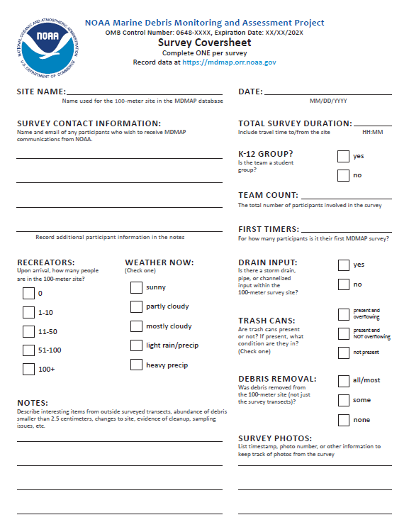
This Survey Coversheet is used to document the conditions at your NOAA Marine Debris Monitoring and Assessment Project site during a survey that could influence debris loads encountered that day. It should be completed once per survey. Quick reference survey tips and reminders are included on the second page. Print this datasheet and bring it with you each time you plan to survey your site.
If you have questions about how to complete this form, please contact NOAA Marine Debris Monitoring and Assessment Project staff at md.monitoring@noaa.gov.
The Marine Debris Monitoring and Assessment Project (MDMAP) is a NOAA citizen science initiative that engages NOAA partners and volunteers across the nation to survey and record the amount and types of marine debris on shorelines. Participants in the MDMAP network select nearby shoreline monitoring sites that they return to routinely to conduct surveys and record information that can be used to compare amounts, locations, movement, sources, and impacts across the United States and internationally. Learn more about our monitoring efforts.
Esta Portada de la Encuesta se utiliza para documentar las condiciones del sitio del Proyecto de Monitoreo y Evaluación de Desechos Marinos de la NOAA durante una encuesta que puede influenciar la cantidad de desechos marinos encontrada ese día. Debe completarse una vez por encuesta. Una referencia rápida de encuesta y recordatorios están incluidos en la página segunda. Imprima esta portada y llevarla por cada vez que encuesta el sitio.
Si tiene preguntas sobre cómo completar este formulario, contacte un miembro del personal del Monitoreo y Evaluación de Desechos Marinos de la NOAA a md.monitoring@noaa.gov.
El Proyecto de Monitoreo y Evaluación de Desechos Marinos (MDMAP) es una iniciativa de ciencia ciudadana de la NOAA que se compromete con compañeros y voluntarios en todo el país para encuestar y registrar la cantidad y los tipos de desechos marinos en la costera. Los participantes en el red del MDMAP seleccionan sitios cercanos para encuesta costera a los que regresan rutinariamente para conducir las encuestas y registrar la información que puede usar para comparar la cantidad, la localización, el movimiento, las fuentes y los impactos en todo de los Estados Unidos y el globo. Aprenda más sobre nuestros esfuerzos de monitoreo.
 An official website of the United States government.