 An official website of the United States government.
.")
Marine debris is a widespread pollution problem in the ocean and waterways. The National Oceanic and Atmospheric Administration (NOAA) Marine Debris Program is the United States Government’s lead for addressing marine debris. The NOAA Marine Debris Program serves as a centralized marine debris resource, coordinating and supporting activities among federal, state, and local agencies, tribes, nongovernmental organizations, academia, and industry.
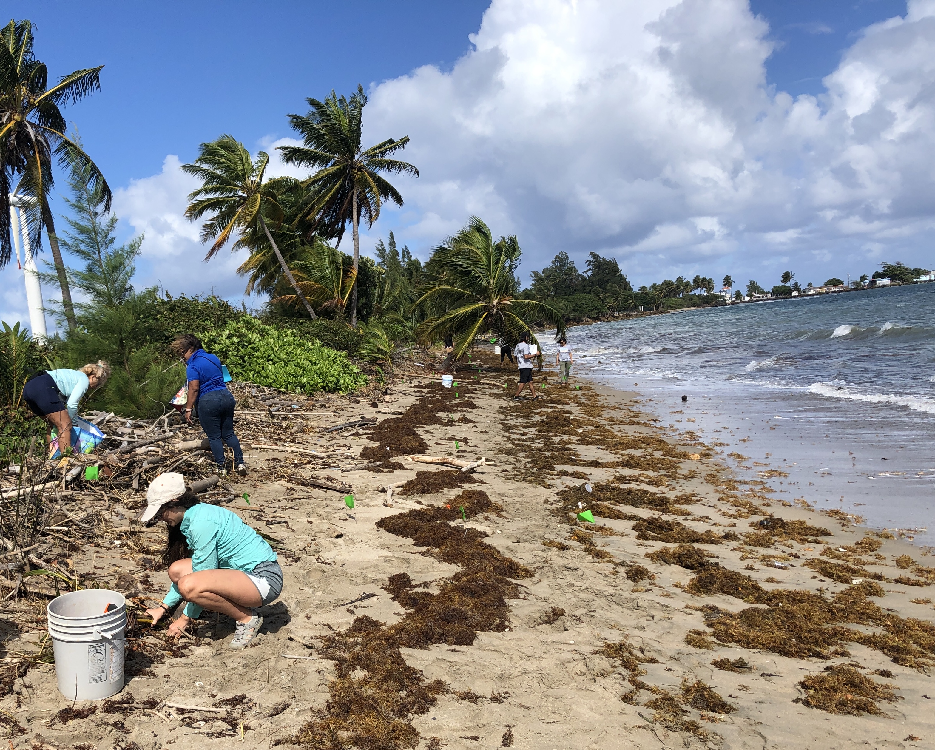
Understanding where, how much, and what kinds of debris are present in the marine environment is important to help combat the problem. This knowledge, along with an understanding of how the amount of marine debris on shorelines is changing over time, is essential to developing new and effective prevention policies and strategies for education and outreach. The Marine Debris Monitoring and Assessment Project (MDMAP, usually pronounced “M-D-MAP”) is a volunteer monitoring program. MDMAP volunteers survey and record the amount and types of marine debris on shorelines. These monitoring protocols were designed to be widely applicable and inexpensive to implement, and intended to promote standardization of shoreline marine debris monitoring efforts. By participating in the MDMAP, volunteers can generate critical data on marine debris for use by community organizations, policymakers, NOAA, and the general public. Participants will also be joining a dynamic and collaborative community of scientists and the public and will have the opportunity to build supportive relationships with NOAA and other partners.
The NOAA Marine Debris Program’s Monitoring Toolbox contains resources for both current and new MDMAP partner organizations and volunteers, including data sheets, tutorial videos, and the MDMAP database. You can learn more about the MDMAP process in Part 1 of our tutorial video series, “Introduction to MDMAP.” All of our tutorial videos are also available in Spanish! If you are interested in watching the MDMAP training videos with your students, we have compiled potential discussion questions for each video.
MDMAP Goals
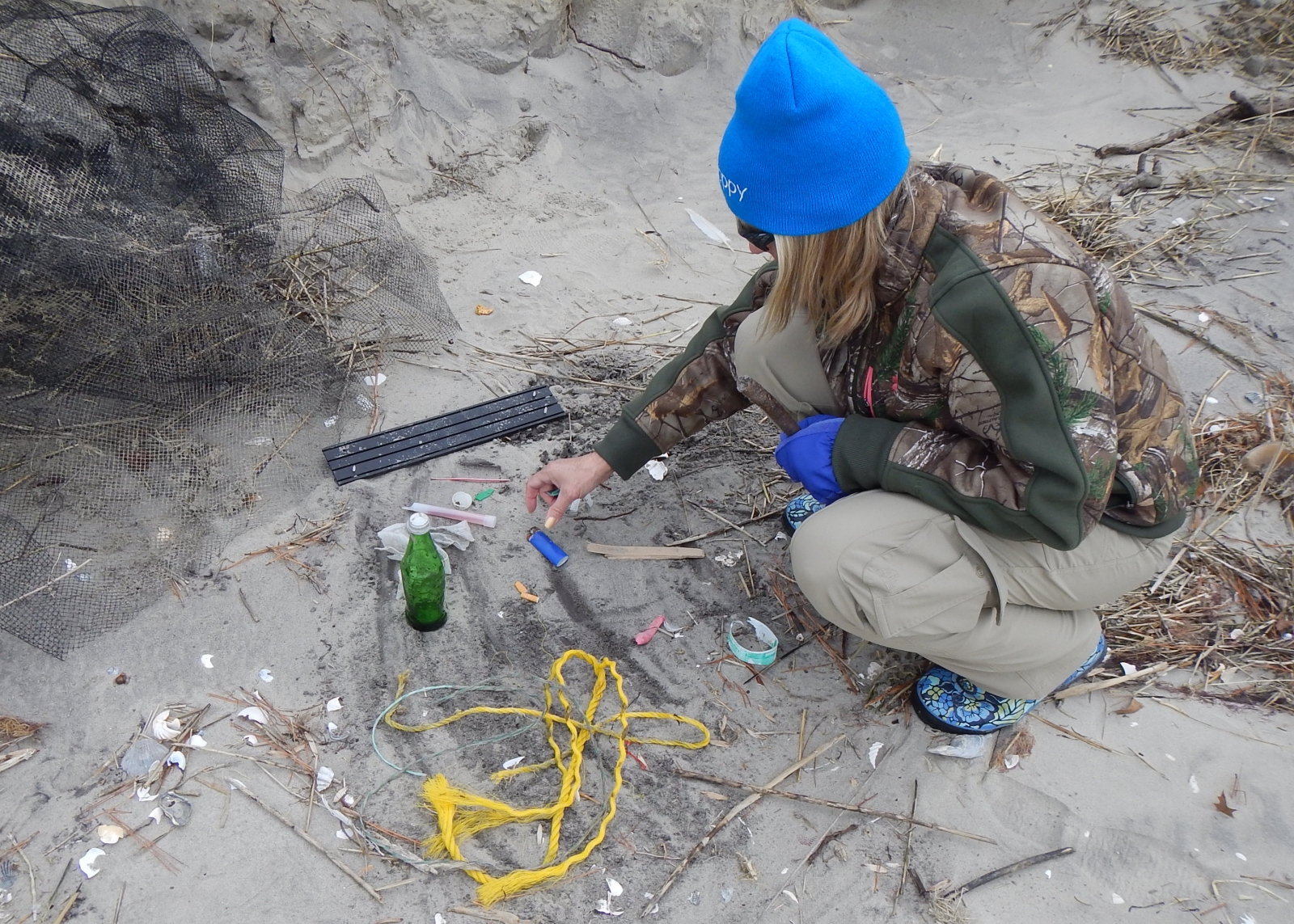
- Detect changes in the amounts and types of marine debris on surveyed sites.
- Ensure data are standardized and useful for broader communities.
- Guide and evaluate prevention strategies to inform priorities and inspire action to reduce marine debris. MDMAP surveys can be used to identify target debris items and behaviors that can reduce marine debris, or to measure before and after an intervention, such as a policy change.
- Provide tools to partners to contribute to the larger picture of marine debris and to meet their own goals of documenting debris on their local shorelines.
Data collected using the methods in this guide can be entered into a secure MDMAP database managed by NOAA, where it is viewable and accessible by other researchers and members of the public worldwide. For examples of past outcomes of MDMAP that range from local projects to larger scale analyses and publications, please check out the How are MDMAP data used? page in the Monitoring Toolbox.
Why conduct MDMAP surveys with your students?
Students can easily recognize the problems posed by marine debris, and they can also independently come up with authentic solutions, including beach cleanups. By incorporating MDMAP within those cleanups or other efforts, educators can introduce students to an accessible and data-rich monitoring effort that makes a measurable difference in an emerging field of science.
Incorporating volunteer monitoring into the classroom helps students develop expertise in the subject, contribute data to authentic science, make meaning of their learning with real-world context, and share their findings with outside audiences to support action on an environmental issue.1 These activities all lead to increased student engagement and youth agency, helping to solidify science concepts and stewardship.
MDMAP is also a great way to get outside, have fun, and get to know your local shoreline. By engaging with local areas and the unique debris issues found there, students can become the experts, stewards, and decision-makers in place-based action to identify and solve problems.
Standards Alignment
Participating in MDMAP walks students through the authentic, ever-evolving phenomenon of marine debris and field surveys. This work positions them as scientists and actively engages them in Next Generation Science Standards Science and Engineering Practices, as well as a number of other three-dimensional science learning standards. Additionally, depending on the approach you take and the focus of your learning environment, the activities in this Guide also address a number of cross-curricular standards in math, social studies, language arts, and other subjects.
You can find in-depth Next Generation Science Standards alignment and additional information on cross-curricular skills development and learning objectives in our supplemental resource: Learning Objectives and Standards Alignment for Making a Marine Debris “MAP”.
Who can collect data for the MDMAP?
Where can MDMAP data be collected?
MDMAP is intended for surveys of shoreline areas, including beaches, riverbanks, and lake shores. Unsure if your area has the right environment? As long as there are 100 meters of walkable shoreline made of sand or rocks, the site can be used for MDMAP surveys!
If your community is located in an area with no walkable shorelines, you can still use the MDMAP protocols and other resources available in this Guide, but you should not upload your data to the MDMAP database. However, you can still use the data to answer questions in your community.
How do we get started?
If you're ready to dive into MDMAP with your students, this Guide will walk you through the following steps for conducting MDMAP surveys:
- Get Ready: Site Selection and Preparation (including practicing survey protocols)
- Before Every Survey: Safety Tips and Transect Selection (including cross-curricular descriptions of methods)
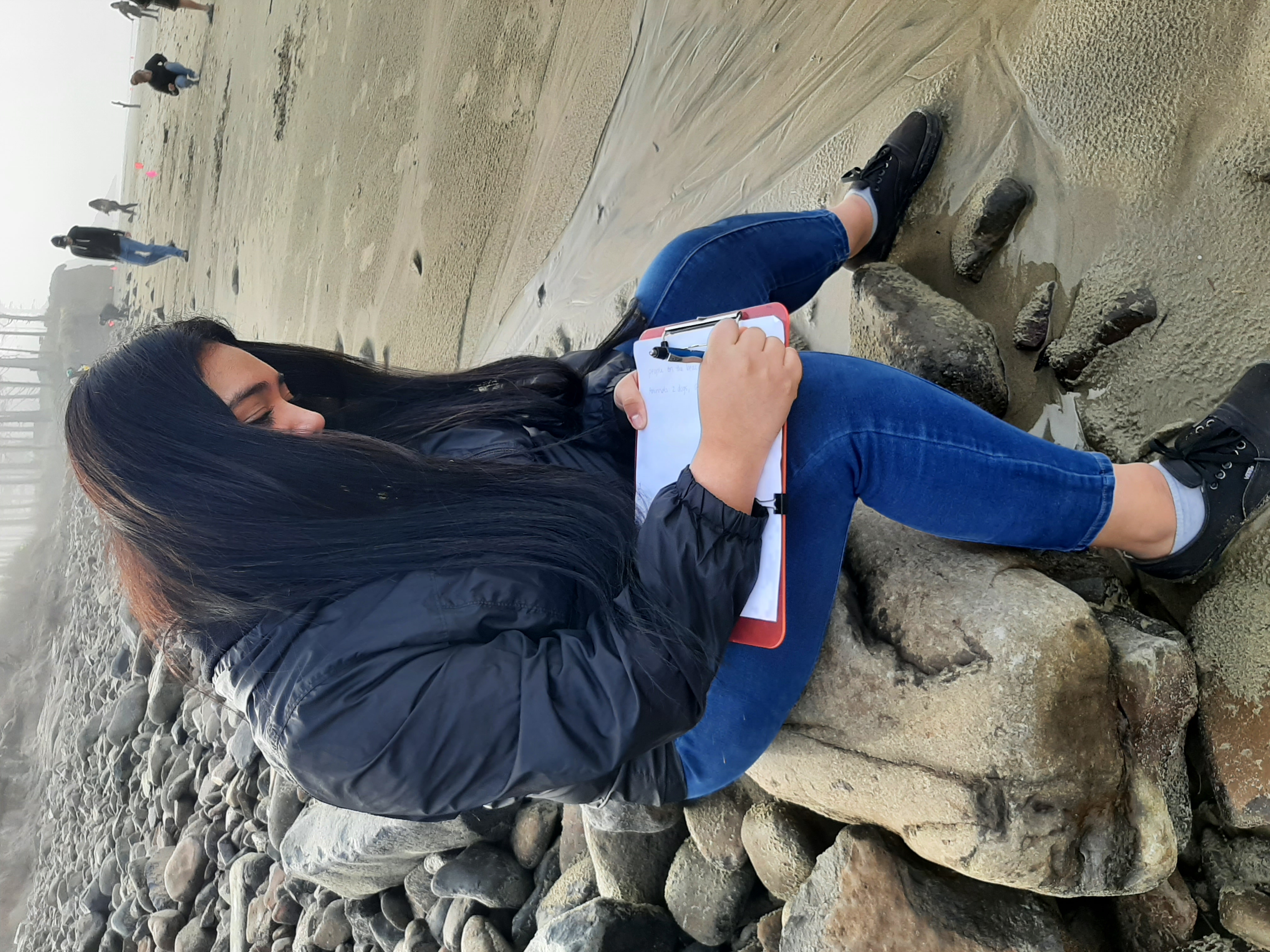
- During the Survey: Survey Protocol (including tips for working with large groups of students)
- After the Survey: Entering Data and Reflecting on the Experience (including ideas and inspiration for student action projects)